| Strada dell’Acquedotto Romano 56 (locality Lobia) - 36100 Vicenza (VI)
|
|
|
Summary
The archaeological area conserves the remains of the Roman aqueduct of Vicenza, that carried water from the springs of the northern plain (Motta di Costabissara) to the “municipium” of Vicenza. Five arches remain today and some abutments, which can all be seen for about 180 metres.History of research
The remains of the aqueduct have always kept visible and have been targeted by researches and studies since the XVIII century. The artefact was restored at the end of the Eighties.
Urban and geographical context
Vicenza is located in the west-central plains of Veneto, at an average altitude of 40 metres above sea level. The city is surrounded by the Berici hills on the south and by the south-eastern margins of the Lessinian mountains of the west/northwest. The remains of the aqueduct of Vicenza are located in the plain north-west to Vicenza, near the Orolo stream which is said to be dry for most of the year.
Chronology
I A.D. |
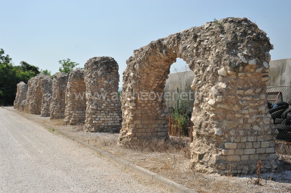 | 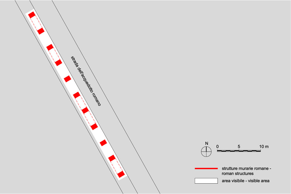 |
Roman aqueduct 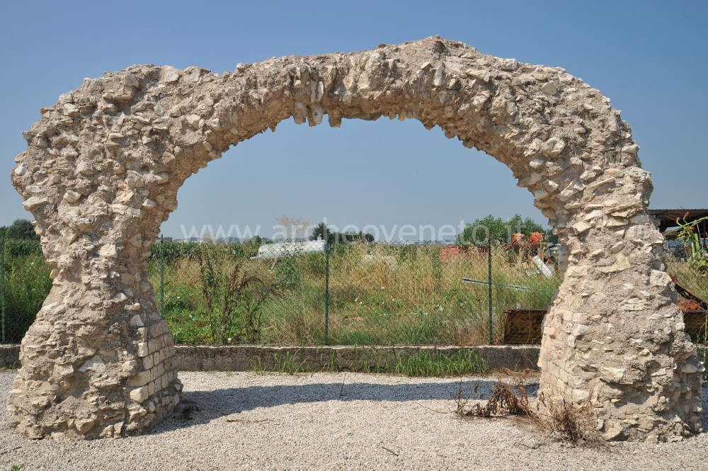 The archaeological area conserves some remains of the Roman aqueduct of Vicenza. It is believed that the aqueduct started from the springs area north of Vicenza, in proximity of Motta di Costabissara, and that it headed towards south up to Vicenza. Particularly, it is possible to see 5 arches and some 20 abutments, for an overall length of 180 metres.
The structure of the aqueduct is in concrete with an external lining in little local sandstone blocks still visible at the basis of some abutments. The bridge rested on segmental arches having constant width of 3,3 metres and increasing height from the hill (“Motta di Costabissara”) to the plain (Vicenza). The abutments that support the arches have a rectangular or cross-shaped section: every eight rectangular abutments there was a cross-sectioned one, which increased the overall stability of the structure. Unfortunately, the state of conservation of the bridge does not provide substantial information on the logline over the arches and where the water run. Some scholars believe that it was a rectangular terracotta logline, 75 cm large and 60 cm high.
On the basis of the building techniques, the structure has been dated to the I century A.D. The archaeological area conserves some remains of the Roman aqueduct of Vicenza. It is believed that the aqueduct started from the springs area north of Vicenza, in proximity of Motta di Costabissara, and that it headed towards south up to Vicenza. Particularly, it is possible to see 5 arches and some 20 abutments, for an overall length of 180 metres.
The structure of the aqueduct is in concrete with an external lining in little local sandstone blocks still visible at the basis of some abutments. The bridge rested on segmental arches having constant width of 3,3 metres and increasing height from the hill (“Motta di Costabissara”) to the plain (Vicenza). The abutments that support the arches have a rectangular or cross-shaped section: every eight rectangular abutments there was a cross-sectioned one, which increased the overall stability of the structure. Unfortunately, the state of conservation of the bridge does not provide substantial information on the logline over the arches and where the water run. Some scholars believe that it was a rectangular terracotta logline, 75 cm large and 60 cm high.
On the basis of the building techniques, the structure has been dated to the I century A.D. |
|
Visiting
Visitability: Esterno;
Ticket: No;
 School access School access
|
Recommended tour time (minutes): 20 |
|
Services for visitors
|
Educational Services
Information boards |
Bibliography
| Marchini G.P. 1979, Vicenza romana: storia, topografia, monumenti, Verona, pp. 140-144. |
| Rigoni M. 1987, Vicenza, in Il Veneto nell’età romana, II, a cura di Cavalieri Manasse G., Verona, pp. 122-123. |
| I luoghi della cultura 2006, Roma, pp. 386. |
| Bonetto J. 2009, Veneto (Archeologia delle Regioni d'Italia), Roma, pp. 468-469. |